


Rhine Atlas
The Rhine Atlas (flood hazard and risk maps of the International River Basin District ‘Rhine’)
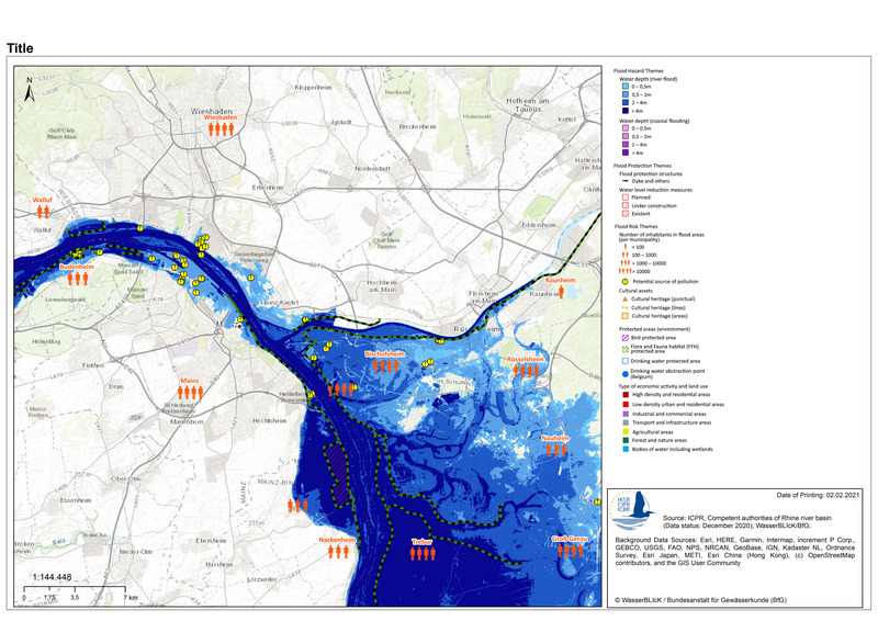
The ICPR Rhine Atlas localizes the kind and degree of danger for the main stream. Together with uses adapted to floods, it also supports the implementation of preventive measures in the planning area.
The Rhine Atlas represents flood hazard and flood risk issues according to the Floods Directive (FD) for the main stream of the Rhine from the Alpine Rhine to the North Sea. It provides a uniform representation of flood areas and their flood risk for three flood scenarios (high, medium and low flood probability).
The Rhine Atlas is made by simplified/aggregated national flood hazard and flood risk maps. Additional information and more detailed national maps are available by clicking on any area of the atlas.
Please click here to open the Rhine Atlas.
Furthermore, you will here find the coordinated report for the implemenation of the Floods Directive concerning the drafting of flood hazard and flood risk maps in the international Rhine river basin.